
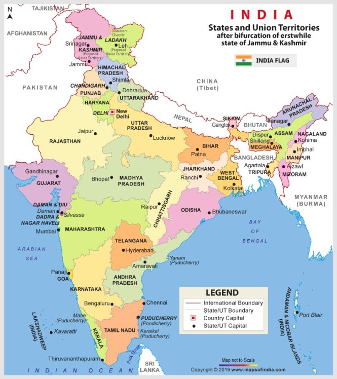
Which States Share Boundaries with Pakistan?
There are four states that share a border with Pakistan, namely, Jammu and Kashmir, Punjab, Rajasthan, and Gujarat. The India–Pakistan Border is quite intriguing. Since India has installed 1,50,000 flood lights on around 50,000 poles, the border can be seen from space at night.
It is also considered the world’s one of the most dangerous borders. Locally, it is also known as International Border (IB). The IB is stretched from Jammu and Kashmir at the north to the Zero Point between Gujarat in India and Sindh province in Pakistan. It is of a total length of 3,323 kilometres.
Following are the more details on the states that share boundaries with Pakistan.
Jammu and Kashmir
The state is located mainly in Himalayan mountains. It has a total geographical area of 2,22,236 sq. km. The Indian state (Union Territory) of Jammu and Kashmir touches Pakistani-administered Gilgit-Baltistan and Azad Kashmir in the north and west respectively. It borders Indian states of Punjab and Himachal Pradesh. Under the Indian Constitution’s Article 370, Jammu and Kashmir has been provided a special autonomy.
Punjab
Having a geographical area of 50,362 sq. km, Punjab touches many India states, besides Pakistani province of Punjab in the west. It borders Indian states of Jammu and Kashmir, Himachal Pradesh, Haryana, and Rajasthan.
Rajasthan
Located in the northwest region of India, Rajasthan touches Pakistani provinces Sindh in the west and Punjab in the northwest. Rajasthan is also India’s largest state by area, covering an area of 3,42,239 sq. km. At other parts, it is bordered by Indian states – Punjab, Haryana, Uttar Pradesh, Madhya Pradesh, and Gujarat.
Gujarat
The state with the third-largest economy borders Pakistani province of Sindh to the west. Gujarat has a total area of 1,96,024 sq. km. It also borders Indian regions, namely, Dadra and Nagar Haveli, Daman and Diu, Maharashtra, and Rajasthan. It is also bordered by the Arabian Sea.
Source – www.mapsofindia.com.


